The UK is currently braced for a significant snowstorm expected to bring snowfall across parts of Britain, raising hopes of a white Christmas. Although widespread, deep snow covering remains unlikely, early signs suggest snow could fall in northern regions, especially Scotland and higher ground, offering at least a festive flake or two.
As the UK prepares for a substantial incoming snowstorm, forecasters are keeping a close eye on the potential for a white Christmas. The article explores the storm’s origins, how snow could shift across the country, and what a “white Christmas” really means by official standards. We’ll dive into historical odds, climate‑change impacts, practical preparedness tips for households and travel, plus a region‑by‑region breakdown of where snow may settle most. Whether you’re dreaming of a snowy festive scene or anxious about disruption, we cover what to expect and how to respond.
What’s Driving the Incoming Snowstorm
The snowstorm headed toward the UK is the result of a low‑pressure system drawing cold air from the Arctic and moist air from the Atlantic. As this mix collides, heavier snow showers are expected particularly in the north and over higher ground. Meteorologists note this pattern tends to favour snow rather than rain, especially when temperatures are just around freezing and moisture is ample. The combination raises the chance of snowfall across the UK, especially in elevated or northerly zones.
Because winter storms in Britain often arrive with little warning, and the track of the low can shift, it’s essential to watch live forecasts from trusted sources like the Met Office. Their updates stress that even a single snowflake over the 24 hours of 25 December qualifies as a white Christmas in the UK. Understanding this weather driver helps in anticipating timing, impact, and where disruption is most likely.
How Likely is a White Christmas in the UK?
By the UK’s official definition a “white Christmas” requires just one snowflake to fall on Christmas Day somewhere in the UK, not necessarily for snow to lie on the ground. Historically around half of all years since 1960 have seen snow falling at one or more stations on 25 December. Met Office Yet, widespread lying snow on Christmas morning is far rarer — only achieved four times since 1960 (1981, 1995, 2009, 2010) when more than 40% of stations recorded snow on the ground.
So in short: yes, the odds of snow falling somewhere are moderate, but the chance of full snow coverage is quite low. With the upcoming storm, we may tick the “snow‑fall” box, though the picturesque blanket of snow remains elusive for many.
Storm Timing & Regions Most at Risk
The forecast suggests the snowstorm will hit beginning late afternoon and evening, sweeping from the north and west toward the central UK through the night. Scotland and northern England are most vulnerable thanks to colder air and higher altitude. Expect heavier snow showers on hills and coastal windward slopes. Lower‑lying southern and eastern areas might see sleet or rain mixed with snow, reducing accumulation.
For those in the risk zones here are bullet points of where to focus preparation:
- Highlands of Scotland and Northern Isles — highest chance of lying snow.
- North Wales and northern England — moderate chance, especially above 200 m.
- Midlands and southern England — mostly milder; snow less likely to persist.
- Coastal and low‑altitude zones — sleet/ rain may dominate, snow may not settle.
Ensuring you monitor updates regionally is key because local variation will matter a lot.
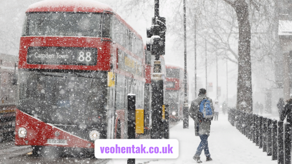
Impacts on Travel, Infrastructure & Daily Life
When a significant snowstorm hits the UK the impacts can ripple across travel, infrastructure, and everyday routines. Roads and motorways may face closures or delays due to drifting snow or icy patches. Rail services, airports and bus networks can be disrupted. Power cuts and blocked driveways might occur in more remote or elevated zones.
Here are bullet points summarising likely disruptions:
- Reduced visibility and slippery roads leading to slower traffic and accidents.
- Rail and air cancellations in regions hit hardest by snow or sleet.
- Schools and workplaces in higher ground may delay or close.
- Essential services (emergency, utilities) may operate with limited capacity.
Being prepared—having supplies, checking travel plans, allowing extra time—is strongly advisable if you’re in the forecast path.
Also read this: Who Is Jamie White-Welling? Her Untold Life Beyond Hollywood
How Climate Change is Shaping Snow Chances
The trend of global warming has gradually reduced the UK’s chance of a dramatic white Christmas. Warmer sea‑and‑air temperatures reduce the number of days when conditions favour heavy snow. The Met Office highlights this shift, noting that snow on Christmas Day is less likely to settle now than in past decades. The effect: while a single snowflake may still fall, the deeper snow very rarely still happens.
In addition the timing of the jet stream and Atlantic weather systems has become more erratic. That means the type of snowstorm that might blanket large areas now has to navigate milder air masses and warmer surfaces. So while our upcoming snowstorm offers a chance for snow, the overarching trend still works against a full white‑Christmas display for many.
White Christmas” Defined and What It Means
One key to understanding all this is the definition of a “white Christmas” in the UK. According to the Met Office an official white Christmas occurs when at least one snowflake is observed falling within the 24‑hour period of 25 December, at any Met‑Office station or observer. In other countries the definition may include snow on the ground for example. In the UK the imagery of thick snowcover is a bonus but not part of the official definition.
That means your chances of the “white Christmas” banner being dipped in ink are better than you think—but the picturesque snow‑covered landscape many imagine remains a bigger ask. The connotation of fluffy white ground, Christmas trees and snow angels is part of the mythos more than the meteorology.
Region‑by‑Region Outlook for the Storm
Scotland & Northern Isles
Scotland, particularly the Highlands and northern coastal zones, are the most likely to see lying snow thanks to colder air and altitude advantage. The snowstorm’s first impacts are expected here. So for those in these parts, the possibility of a festive snowy scene is highest.
Northern England & North Wales
These regions will get moderate to heavy snow showers especially over hills or plains near uplands. Settling snow is possible in elevated pockets. Areas below 200 m elevation may mostly see sleet or snow that doesn’t last. Be cautious on roads and travel into and out of hilly terrain.
Midlands & Southern England
Here the outlook is milder. The cold air may be shallower and warmer air may override the snow, so expect mix of sleet, rain or wet snow. Lying accumulations are less likely and any snow cover may melt quickly or fail to develop.
Central & Coastal Zones
The storm’s leading edge may bring snow/ sleet but warmer maritime air and windchill may limit accumulation. Winds may blow snow off roads and surfaces, and drifting may not create stable snowy surfaces. For these areas: the festive white picture is possible but less probable.
Preparation Tips for Households
Here are bullet points of what households across the UK should consider ahead of the storm:
- Stock up on essentials (food, medicine, batteries) in case of short‑term isolation.
- Check heating systems and insulation especially in older or rural properties.
- Insulate pipes and know how to shut off water to prevent freezing and burst pipes.
- Clear driveways and paths pre‑emptively (before snow falls in earnest) and have de‑icer or grit ready.
By being proactive you’ll be better set to cope if the snowstorm brings disruption or lying snow.
Travel and Safety Advice
Travel‑wise if you’re commuting or plan to travel over the next few days the best approach is caution, flexibility and information. Monitor travel updates, allow extra journey time and consider alternatives if you’re crossing high ground. Because lying snow and icy roads are possible, even if widespread cover doesn’t develop.
Take into account the following:
- Keep windscreen and windows clear of snow and ice before setting off.
- Consider winter tyres or chains if driving in upland areas.
- Ensure your vehicle has supplies (blanket, torch, shovel, water) for winter conditions.
- For public transport check for delays or cancellations due to snow or ice especially in northern/hilly zones.
Being ready helps you dodge the bulk of disruption and travel safely even if the storm brings lying snow.
Business, Infrastructure and Community Readiness
Local authorities, utility companies and emergency services are also preparing for the storm’s impact. Gritting teams will be out, rail operators are scheduling flexibility and local councils are readying snow‑clear fleets in vulnerable zones. Power networks check for vulnerability to ice and snow loads.
For communities and businesses this means:
- Schools and workplaces should have contingency plans for disruption (remote work, closures).
- Retailers and supply chains (especially food/‑medical) should anticipate possible delivery delays.
- Care homes and vulnerable community centres should check heating, access and supplies.
- Local communications should keep residents informed of disruptions, clearance operations and safety advice.
Preparation ahead of time being better than scrambling during the storm improves resilience for all.
The Bigger Picture — Snow Season Context
While all eyes are on the upcoming snowstorm and the possibility of a white Christmas, it’s worth remembering that in the UK the main snow season runs across January and February rather than December. Studies show December has fewer and less intense snow days than the core winter months. The Week+1 That means while the festive mood might focus on snow for 25 December, the bulk of lying snow events will generally appear later in winter.
Thus for those chasing the full “blanket of white” dream the festive day may deliver a taste—but the deeper snow cover likely awaits later. Even so, the storm now arriving offers one of the better chances this season for some festive sparkle.
Will the Storm Definitely Bring a White Christmas?
The short answer: not guaranteed. Forecasts can change, and small shifts in temperature, wind or storm track may turn snow into sleet or rain. Even if snow falls, whether it sticks and provides that classic snowy scene depends on ground temperatures, persistent cold at night and a good storm track. The definition of a white Christmas means only snow falling is required—but for many that will not match the ideal of snow‑covered lawns and rooftops.
That said, the current forecast offers favourable ingredients: a cold air mass, moisture from the Atlantic, plus the right wind directions. So the odds are elevated compared to a typical December, especially in northern/higher areas. Keep monitoring the forecast and plan accordingly for both hope and caution.
What If Snow Doesn’t Settle? Managing Expectations
If the snowstorm fails to result in a white Christmas there are still plenty of ways to enjoy festive winter vibes. Snow showers may still occur even if lying snow doesn’t stack up. Localised dustings can create scenes of beauty even if limited. For many in the UK, snow on or around Christmas still offers a boost to the season.
Also:
- Consider winter walks in upland or northern areas where snow may linger.
- Enjoy the storm from the warmth of home with the knowledge you were ready.
- Document the event: even a few flakes caught on film make for memorable Christmas stories.
- Prepare for a later snow‑event: the winter is still young and more snow may arrive after the holiday.
So even if the full dreamy snow‑scene doesn’t appear, there’s reason to appreciate the storm’s potential and the festive mood.
Conclusion
In conclusion the UK is indeed braced for a significant snowstorm that boosts the chances of a white Christmas—according to the UK definition of snow falling on 25 December. Regions in Scotland and northern England are most likely to benefit from snow showers and possible lying cover. While a full picture‑postcard snow blanket remains unlikely for much of the country, the storm offers one of the stronger chances this season. Preparation across households, travel, infrastructure and business is key to making the most of the situation—whether you end up with a few flakes, a dusting, or a truly snowy scene. Stay weather‑aware, plan ahead, and enjoy the festive buildup no matter what unfolds.
FAQs (with short answers)
- What exactly counts as a “white Christmas” in the UK?
In the UK it means at least one snowflake must be observed falling in the 24 hours of 25 December somewhere in the country. - How often does the UK see a white Christmas?
Since 1960 about half the years have recorded at least one snowflake falling on Christmas Day. - Could we see heavy snow and wide coverage this time?
It’s possible in certain higher and northern locations, but widespread heavy coverage is still unlikely due to warmer air and prevailing patterns. - Which regions are most likely to see snow from this storm?
The Highlands of Scotland, northern England and parts of North Wales (especially higher ground) are at highest risk for snow from the incoming storm. - How should I prepare for the snowstorm at home?
Stock up on essentials, check heating and insulation, clear driveways before the snow arrives, and keep travel plans flexible in case of disruption.
Fore more info: veohentak.co.uk